Table of Contents
Quality Service Guarantee Or Painting Free

Get a rental agreement with doorstep delivery

Find the BEST deals and get unbelievable DISCOUNTS directly from builders!

5-Star rated painters, premium paints and services at the BEST PRICES!
Loved what you read? Share it with others!

Delhi Metro Routes: Routes, Map, Parking, Station List and Nearby Localities to Live in 2025
Published : January 31, 2025, 12:00 AM
Updated : October 1, 2025, 12:08 PM
Author :
Prakhar
Table of Contents
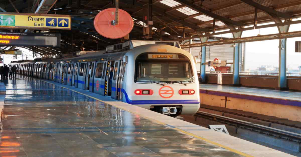
Imagine waking up in Delhi, bustling with life – street vendors calling out, colourful markets, and a city that never rests. As the sun rises over iconic landmarks like the Red Fort, a new day begins in Delhi. In this lively chaos, the Delhi Metro isn't just a train system; it's the heartbeat connecting the city. More than just a way to get around, it's like veins crisscrossing Delhi, ensuring it functions seamlessly.
Metro Rail Delhi: A Quick Information
The Delhi Metro is India’s largest and busiest metro rail system. It connects Delhi with neighbouring cities like Noida, Ghaziabad, Gurgaon, Faridabad, and Bahadurgarh.
| Information | Details |
| Metro name | Delhi metro |
| Owner | Delhi Metro Rail Corporation |
| Operator | Delhi Metro Rail Corporation |
| Locale | National Capital Region (NCR) |
| Total lines | 10 |
| Total stations | 289 |
| Total length | 395 km |
| Website | https://www.delhimetrorail.com/ |
| Opened date | 24 December 2002 |
| Type of transit | Rapid |
| Interchanges | Noida Metro, Rapid Metro Gurgaon |
| Number of depots | 15 |
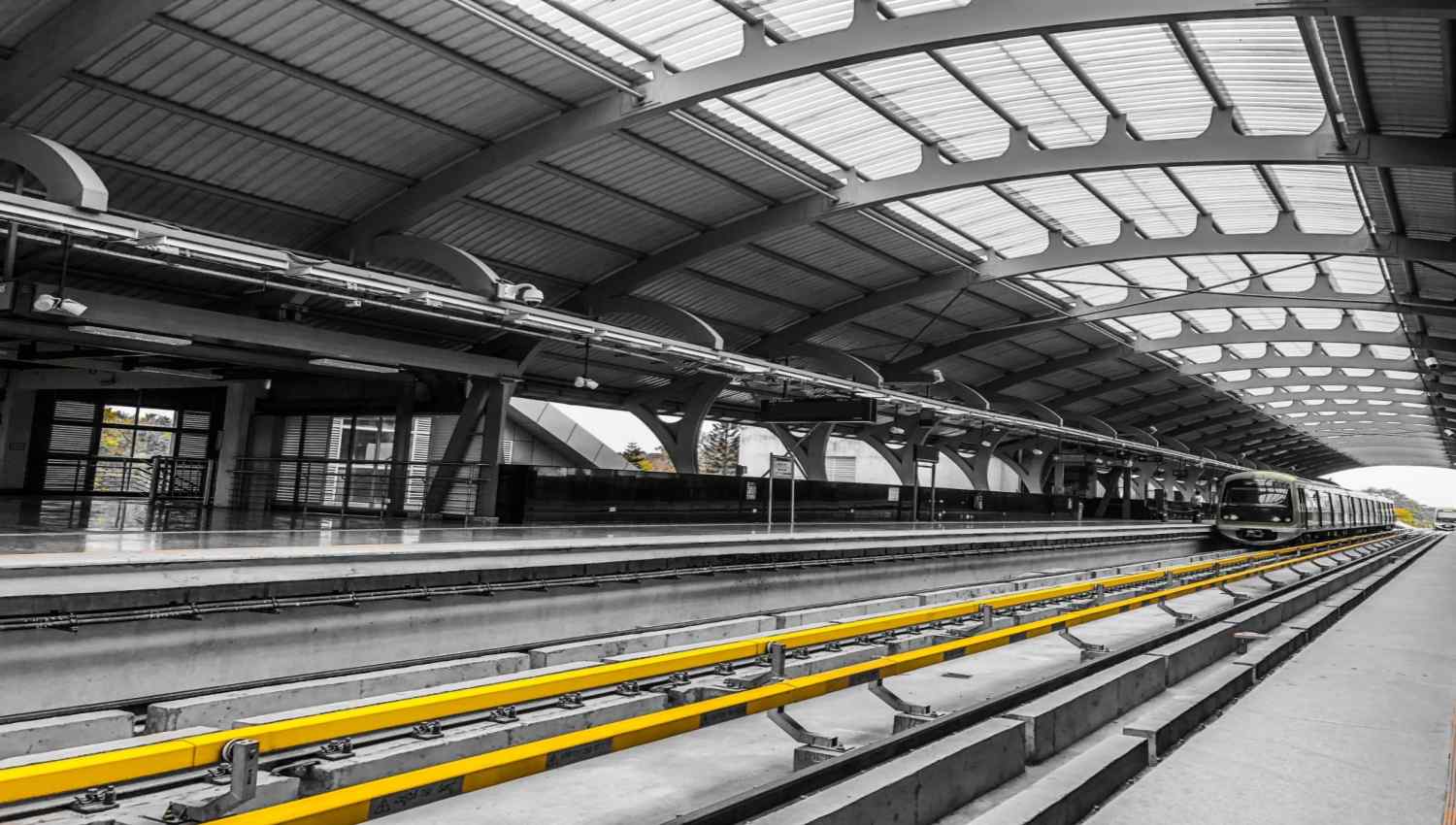
Delhi Metro Route Map
The Delhi Metro is the backbone of public transportation in the National Capital Region. With a total Delhi Metro length of over 390 kilometres, it ranks among the third-longest metro networks in the world. Here is the Delhi metro station map:
Quality Service Guarantee Or Painting Free
Get a rental agreement with doorstep delivery
Find the BEST deals and get unbelievable DISCOUNTS directly from builders!
5-Star rated painters, premium paints and services at the BEST PRICES!

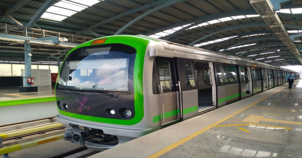
Delhi Metro Overview: A Journey Through Time and Tracks
Delhi Metro, the lifeline of the capital, emerged onto the scene on December 24, 2002, marking the beginning of a transformative era in the city's transportation landscape. Let's embark on a journey, tracing the initial lines that laid the foundation for the extensive network we see today.
- Founding the Lifeline (2002): The inaugural Red Line (Line 1) connected Shahdara to Tis Hazari, beginning the dawn of a new era in Delhi's commuting history. The excitement was palpable as people boarded the sleek trains, unknowingly setting the stage for a sprawling metro network.
- Colouring the City (2002-2010): In the subsequent years, the city's map started to resemble a vibrant mosaic as new lines crisscrossed its expanse. Yellow, Blue, Green – each colour denotes a new route, a new connection. The metro wasn't merely a mode of transport; it was a symbol of Delhi's dynamic growth.
Delhi Metro: Connecting NCR
As the city expanded, so did the reach of the Delhi Metro.
- From City to Region (2010 Onwards): Breaking geographical barriers, the metro extended its arms to embrace the entire National Capital Region (NCR). Noida, Gurgaon, Ghaziabad and Faridabad – these once-distant areas became seamlessly connected, fostering a sense of unity across the urban landscape.
- Airport Express (2011): In 2011, the Airport Express Line took off, revolutionising travel to and from the airport. Swift, comfortable, and efficient – it became the preferred choice for many jet-setters.
- Rapid Metro (2013): The story didn't stop there. Rapid Metro Gurugram joined the narrative, catering specifically to the bustling Cyber City. It wasn't just about reaching a destination; it was about making the journey smoother and more enjoyable.
Delhi Metro: Current Operational Lines
As of 2025, Delhi Metro stands as a network of diverse lines, each with its unique colour and purpose.
- Red Line (Line 1): Rithala to Shaheed Sthal (New Bus Adda)
- Yellow Line (Line 2): Samaypur Badli to Millennium City Centre Gurugram
- Blue Line (Line 3): Noida Electronic City to Dwarka Sector 21
- Blue Line (Line 4): Vaishali to Yamuna Bank
- Green Line (Line 5): Brigadier Hoshiar Singh to Indraprastha/Delhi Airport
- Violet Line (Line 6): Raja Nahar Singh (Ballabhgarh) to Kashmere Gate
- Pink Line (Line 7): Majlis Park to Shiv Vihar
- Magenta Line (Line 8): Janakpuri West to Botanical Garden
- Grey Line (Line 9): Dhansa Bus Stand Dwarka to Bahadurgarh City Park
- Orange Line (Airport Express): New Delhi to Dwarka Sector 25
Delhi Metro Fares and Operational Timings
Delhi Metro follows a dynamic fare system, where the fare is determined based on the distance travelled. The minimum fare is ₹20, and the maximum fare is ₹60. The fare details for different trip cards are as follows:
Delhi Metro Fare Structure
| Type of Ticket | From/To | Fare (INR) |
| Single Journey Token | New Delhi to Yashobhoomi Dwarka Sector 25 | ₹70 |
| Single Journey Token | New Delhi to any other station | ₹10 - ₹60 |
| Single Journey Token | Yashobhoomi Dwarka Sector 25 to any other station | ₹30 - ₹70 |
| 10 Trip Card (valid for 15 days) | New Delhi to Yashobhoomi Dwarka Sector 25 | ₹600 |
| 10 Trip Card (valid for 15 days) | New Delhi to any other station | ₹150 - ₹460 |
| 10 Trip Card (valid for 15 days) | Yashobhoomi Dwarka Sector 25 to any other station | ₹250 - ₹550 |
| 30 Trip Card (valid for 1 Calendar Month) | New Delhi to Yashobhoomi Dwarka Sector 25 | ₹1850 |
| 30 Trip Card (valid for 1 Calendar Month) | New Delhi to any other station | ₹350 - ₹1600 |
| 30 Trip Card (valid for 1 Calendar Month) | Yashobhoomi Dwarka Sector 25 to any other station | ₹750 - ₹1850 |
Delhi Metro Timings
| Day | First Train | Last Train |
| Monday to Saturday | 5:00 AM | Around 11:00 PM |
| Sunday | 5:30 AM | Around 11:00 PM |
Please note that operational timings may vary for each line. For the most accurate and up-to-date information on fares and operational timings, it's advisable to check the official Delhi Metro website or app.
Delhi Metro Red Line (Line 1): Rithala Shahid Sthal (New Bus Adda) to Shaheed Sthal (New Bus Adda)
Delhi Metro Red Line's first stretch opened in December 2002. This rapid transit is the third most-used metro line. Below is the map for the Red Line:

Station List (North to South)
| Station | Interchange |
| Rithala Shahid Sthal (New Bus Adda) | No |
| Rithala | No |
| Rohini West | No |
| Rohini East | No |
| Tis Hazari | Yes (Yellow Line) |
| Jahangirpuri | No |
| Model Town | No |
| GT Karnal Road | No |
| Azadpur | No |
| Pitampura | No |
| Shastri Nagar | No |
| Kashmere Gate (Interchange with Yellow Line) | Yes (Yellow Line) |
| Patel Nagar | Yes (Green Line) |
| Rajendra Place | No |
| Karol Bagh | No |
| Jhandewalan | No |
| RK Ashram Marg | No |
| Barakhamba Road | Yes (Blue Line) |
| New Delhi (Interchange with Airport Express, Yellow Line, and Magenta Line) | Yes (Orange Line, Yellow Line, Magenta Line) |
| Chandni Chowk | Yes (Yellow Line) |
| Shaheed Sthal (New Bus Adda) | No |
South to North
The station order remains the same when travelling from south to north, but the direction names change accordingly. For example, Chandni Chowk becomes the first station, and Rithala Shahid Sthal (New Bus Adda) becomes the last.
Interchanges
- Kashmere Gate: Yellow Line (Line 2)
- New Delhi: Airport Express (Orange Line), Yellow Line (Line 2), and Magenta Line (Line 8)
Delhi Metro Red Line: Additional Information
- The Red Line is the oldest and busiest line of the Delhi Metro.
- It covers a distance of approximately 34.55 km (21.47 miles).
- Trains run at a frequency of 3-5 minutes during peak hours and 5-15 minutes during off-peak hours.
- Travel time between Rithala Shahid Sthal (New Bus Adda) and Shaheed Sthal (New Bus Adda) is approximately 60 minutes.
Delhi Metro Yellow Line (Line 2): Samaypur Badli to Millennium City Centre Gurugram
Delhi Metro Yellow Line is one of the busiest and most crucial corridors in the entire network. It connects the northern and southern parts of the city and covers major areas like Kashmere Gate, New Delhi Railway Station, Rajiv Chowk, Central Secretariat, AIIMS, and Saket. And this line is the first underground line to open on the Delhi Metro network.
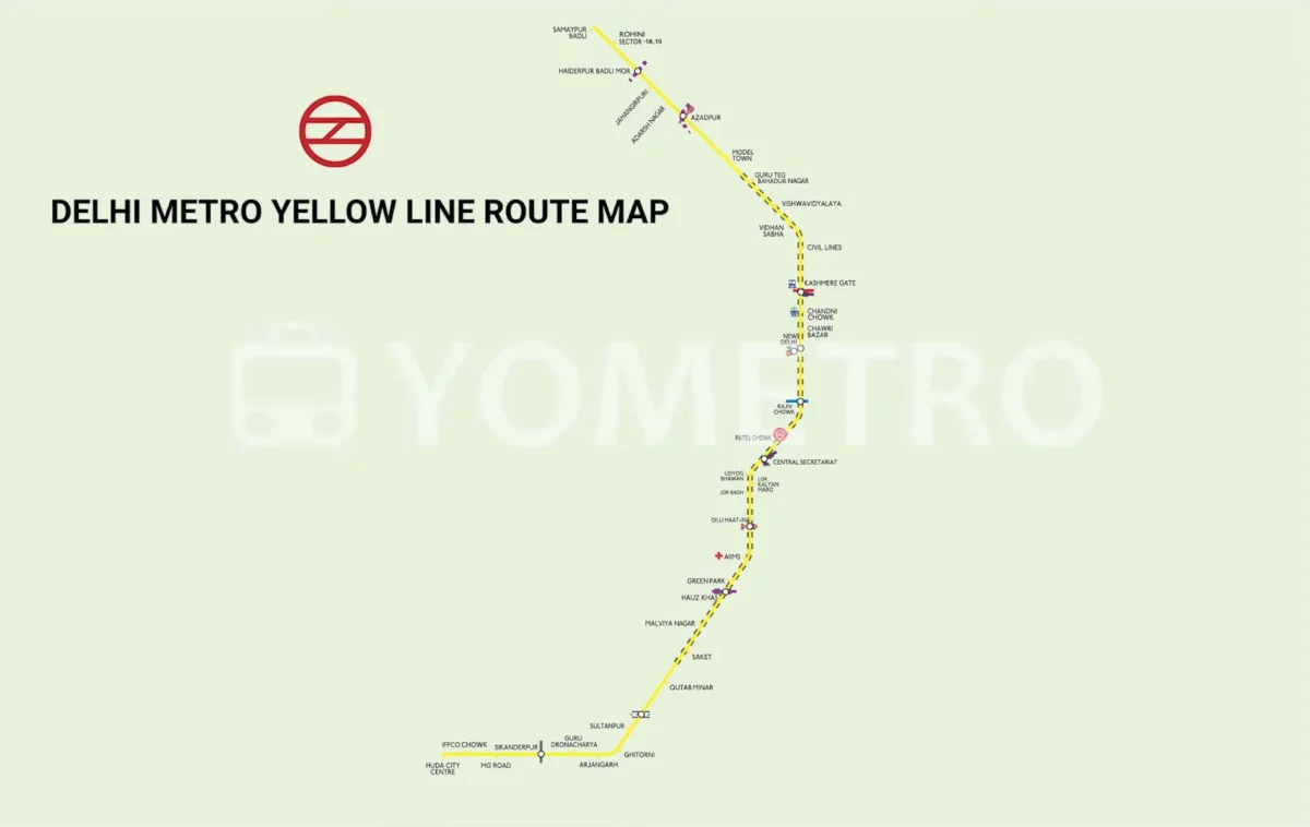
Station List (North to South)
| Station | Interchange |
| Samaypur Badli | No |
| Hitesh Nagar | No |
| Azadpur | No |
| Model Town | No |
| GT Karnal Road | No |
| Vishwavidyalaya | No |
| Iffco Chowk | No |
| Pitampura | No |
| Shalimar Bagh | No |
| Shastri Nagar | No |
| Kashmere Gate (Interchange with Red Line) | Yes (Red Line) |
| Rajiv Chowk | Yes (Blue Line) |
| Patel Nagar | Yes (Green Line) |
| Rajendra Place | No |
| Karol Bagh | No |
| Jhandewalan | No |
| RK Ashram Marg | No |
| Barakhamba Road | Yes (Blue Line) |
| HUDA City Centre | Yes (Rapid Metro Gurugram) |
| Sikanderpur | Yes (Rapid Metro Gurugram) |
| Gurgaon | Yes (Rapid Metro Gurugram) |
| Iffco Chowk | Yes (Rapid Metro Gurugram) |
| MG Road | Yes (Rapid Metro Gurugram) |
| Sikanderpur Metro Station (Interchange with Rapid Metro) | Yes (Rapid Metro Gurugram) |
| Delhi Cantt | Yes (Rapid Metro Gurugram) |
| Gurgaon HUDA City Centre | Yes (Rapid Metro Gurugram) |
| Sultanpur | Yes (Rapid Metro Gurugram) |
| Gurugram Rapid Metro (Interchange with Rapid Metro) | Yes (Rapid Metro Gurugram) |
| Cyber City | Yes (Rapid Metro Gurugram) |
| HUDA City Centre | Yes (Rapid Metro Gurugram) |
| Behrampur | Yes (Rapid Metro Gurugram) |
| Arjun Nagar | Yes (Rapid Metro Gurugram) |
| Sikanderpur Metro Station (Interchange with Rapid Metro) | Yes (Rapid Metro Gurugram) |
| Gurugram Rapid Metro (Interchange with Rapid Metro) | Yes (Rapid Metro Gurugram) |
| Gurugram HUDA City Centre | Yes (Rapid Metro Gurugram) |
| Sector 45 Rapid Metro (Interchange with Rapid Metro) | Yes (Rapid Metro Gurugram) |
| Sector 51 HUDA City Centre | Yes (Rapid Metro Gurugram) |
| Iffco Chowk | Yes (Rapid Metro Gurugram) |
| MG Road | Yes (Rapid Metro Gurugram) |
| Sikanderpur Station | Yes (Rapid Metro Gurugram) |
| Delhi Cantt | Yes (Rapid Metro Gurugram) |
| Gurgaon | Yes (Rapid Metro Gurugram) |
| Micromax Chowk | Yes (Rapid Metro Gurugram) |
| Golf Course Road | Yes (Rapid Metro Gurugram) |
| Rajiv Chowk | Yes (Rapid Metro Gurugram) |
| Udyog Nagar | No |
| HUDA City Centre | Yes (Rapid Metro Gurugram) |
| Sikanderpur Metro Station (Interchange with Rapid Metro) | Yes (Rapid Metro Gurugram) |
| Gurugram Rapid Metro (Interchange with Rapid Metro) | Yes (Rapid Metro Gurugram) |
| Gurugram HUDA City Centre | Yes (Rapid Metro Gurugram) |
| Sector 45 Rapid Metro (Interchange with Rapid Metro) | Yes (Rapid Metro Gurugram) |
| Sector 56 Rapid Metro (Interchange with Rapid Metro) | Yes (Rapid Metro Gurugram) |
| Millennium City Centre | Yes (Rapid Metro Gurugram) |
South to North
The station order remains the same when travelling from south to north, but the direction names change accordingly. For example, Millennium City Centre becomes the first station, and Samaypur Badli becomes the last.
Interchanges
- Kashmere Gate: Red Line (Line 1)
- Sikanderpur Metro Station: Gurugram Rapid Metro
- Delhi Cantt: Rapid Metro
- Gurugram Rapid Metro: Rapid Metro
- Sector 45 Rapid Metro: Rapid Metro
- Sector 51 HUDA City Centre: Rapid Metro
- Sikanderpur Metro Station: Rapid Metro
- Gurugram Rapid Metro: Rapid Metro
Delhi Metro Yellow Line: Additional Information
- The Yellow Line is the second oldest and longest line of the Delhi Metro.
- It covers a distance of approximately 49.02 km (30.46 miles).
- Trains run at a frequency of 3-5 minutes during peak hours and 5-15 minutes during off-peak hours.
- Travel time between Samaypur Badli and Millennium City Centre is approximately 69 minutes.
- The line connects Delhi with the city of Gurugram in Haryana.
Delhi Metro: Blue Line (Line 3): Noida Electronic City to Dwarka Sector 21
The Blue Line Delhi Metro is one of the city's longest lines, serving the east-west corridor. It stretches from Dwarka Sector 21 in West Delhi to Noida City Centre and Vaishali in the east through a branch line, connecting major residential, commercial, and institutional areas across the National Capital Region.

Station List
| Station | Interchange |
| Noida Electronic City | No |
| Knowledge Park II | No |
| Greater Noida | No |
| Pari Chowk | No |
| Noida Sector 18 | No |
| Noida Sector 16 | No |
| Noida City Centre | No |
| Noida Sector 15 | No |
| Noida Golf Course | No |
| Okhla Vihar | No |
| Jasola Vihar Shaheen Bagh | No |
| Kalkaji Mandir | No |
| Nehru Place | No |
| Lajpat Nagar | No |
| Moolchand | No |
| Saket | No |
| Pushpanjali | No |
| Malviya Nagar | No |
| Hauz Khas | No |
| Green Park | No |
| Delhi Public School | No |
| Patel Nagar | No |
| Rajendra Place | No |
| Karol Bagh | No |
| Jhandewalan | No |
| RK Ashram Marg | No |
| Barakhamba Road | Yes (Blue Line - Branch 1) |
| New Delhi (Interchange with Yellow Line, Airport Express, and Magenta Line) | Yes (Yellow Line, Airport Express, Magenta Line) |
| Rajiv Chowk | Yes (Blue Line - Branch 1) |
| Kashmere Gate (Interchange with Red Line) | Yes (Red Line) |
| Yamuna Bank | Yes (Blue Line - Branch 1) |
| Akshardham | Yes (Blue Line - Branch 1) |
| Mayur Vihar Phase 1 | Yes (Blue Line - Branch 1) |
| Dwarka Sector 21 | Yes (Blue Line - Branch 1) |
Travel Time and Frequency
- Travel time between Noida Electronic City and Dwarka Sector 21 is approximately 1 hour and 45 minutes to 2 hours, depending on the trains you take.
- Train frequency on this branch is generally good, with trains arriving every 3-5 minutes during peak hours and 5-15 minutes during off-peak hours.
Delhi Metro: Blue Line: Additional Information
- You can purchase tickets from ticket counters at stations or through the official Delhi Metro app.
- Be aware of peak hours (7:00 AM to 10:00 AM and 5:00 PM to 9:00 PM) when crowds can be heavy.
- Consider your destination within Dwarka Sector 21 as there might be additional travel required through local buses or other transportation options.
- Consider your destination within Dwarka Sector 21, as additional travel might be required through local buses or other transportation options.
Delhi Metro Blue Line (Line 4): Vaishali to Yamuna Bank
Station List
| Station | Interchange |
| Vaishali | No |
| Anand Vihar | Yes (Blue Line - Branch 1) |
| Karkar Duma | Yes (Blue Line - Branch 1) |
| Preet Vihar | Yes (Blue Line - Branch 1) |
| Nirman Vihar | Yes (Blue Line - Branch 1) |
| Laxmi Nagar | Yes (Blue Line - Branch 1) |
| Yamuna Bank | Yes (Blue Line - Branch 3 and Magenta Line) |
Travel Time and Frequency
- Travel time between Vaishali and Yamuna Bank is approximately 13 minutes.
- Trains run at a frequency of 3-5 minutes during peak hours and 5-15 minutes during off-peak hours.
Delhi Metro Blue Line 4: Additional Information:
- This line is a relatively short branch of the Blue Line, primarily connecting Vaishali and Ghaziabad to the main Blue Line network at Yamuna Bank.
- At Yamuna Bank, you can transfer to other branches of the Blue Line (Noida Electronic City to Dwarka Sector 21 and Noida Sector -16 to Yamuna Bank) or the Magenta Line.
- Consider purchasing a single journey token or a travel card for your journey, depending on your travel frequency.
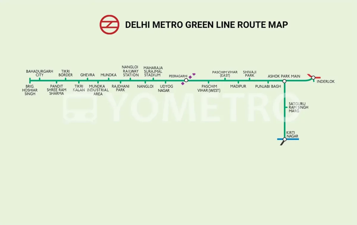
Delhi Metro Green Line (Line 5): Brigadier Hoshiar Singh to Inderlok
The Delhi Metro Green Line is a key corridor connecting the western parts of Delhi to the rest of the city. It runs from Inderlok to Brigadier Hoshiyar Singh (Bahadurgarh), passing through important residential and industrial areas such as Punjabi Bagh, Nangloi, and Mundka.
Phase 3 Extension
| Station |
| Brigadier Hoshiar Singh |
| Tikri Border |
| Tikri Kalan |
| Ghevra |
| Mundka Industrial Area |
Phase 2
| Station |
| Mundka |
| Najafgarh |
| Matiala |
| Dwarka |
| Nangloi |
| Janakpuri West |
| Delhi Cantonment |
| Shivaji Park |
| Ramesh Nagar |
| Moti Nagar |
| Rajendra Place |
| Patel Nagar |
| Kirti Nagar |
| Ashram |
| I P Extension |
| Punjabi Bagh West |
| Punjabi Bagh East |
| Ashok Park Main |
| Sikandarpur |
| Sultanpur |
| Malviya Nagar |
| Green Park |
| Hauz Khas |
| AIIMS |
Phase 1
| Station |
| South Extension |
| Moolchand |
| Lajpat Nagar |
| Vinoba Puri |
| Jangpura |
| Akshardham |
| New Ashok Nagar |
| Mayur Vihar Phase-I |
| Patel Nagar |
| Supreme Court |
| Pragati Maidan |
| Inderlok |
Travel Time and Frequency
- The Delhi Metro Green Line's distance from Brigadier Hoshiar Singh to Inderlok is 25.7 km, and it usually takes 1 hour and 6 minutes to travel there.
- The frequency of trains on the Green Line varies depending on the time of day. During peak hours, trains run every 2-3 minutes, and during off-peak hours, they run every 5-10 minutes.
Delhi Metro Green Line: Additional Information
- The Green Line was the first Delhi Metro line built on a standard gauge.
- The Kirti Nagar branch, opened in 2011, was the first metro line extension in Delhi.
- The line is elevated throughout its entire length.
- It covers several important areas of Delhi, including industrial zones, markets, and residential neighbourhoods.
- It is a popular choice for commuters due to its fast and reliable service.
Delhi Metro Violet Line (Line 6) - Travel Information: Raja Nahar Singh (Ballabhgarh) to Kashmere Gate
Delhi Metro Violet Line consists of 34 metro stations and connects the Kashmere Gate station in New Delhi with Raja Nahar Singh in Ballabhgarh via Faridabad.

Stations
| Station | Interchange |
| Raja Nahar Singh | No |
| Sant Surdas | No |
| Sihi | No |
| Escorts Mujesar | No |
| Bata Chowk | No |
| Neelam Chowk Ajronda | No |
| Old Faridabad | Yes (Violet Line - Extension) |
| Badkal Mor | No |
| Sector 28 Faridabad | No |
| Mewala Maharajpur | No |
| N.H.P.C. Chowk | No |
| Sarai | No |
| Badarpur Border | Yes (Magenta Line - Line 8) |
| Tughlakabad | Yes (Yellow Line - Line 2) |
| Okhla Vihar | Yes (Magenta Line - Line 8) |
| Jasola Apollo | Yes (Magenta Line - Line 8) |
| Nehru Place | Yes (Magenta Line - Line 8) |
| Kalkaji Mandir | Yes (Magenta Line - Line 8) |
| Govind Puri | Yes (Magenta Line - Line 8) |
| Lajpat Nagar | Yes (Pink Line - Line 7) |
| Munirka | Yes (Magenta Line - Line 8) |
| Delhi University | Yes (Pink Line - Line 7) |
| ITO | Yes (Pink Line - Line 7) |
| Kashmere Gate | Yes (Red Line - Line 1, Yellow Line - Line 2) |
Travel Time and Frequency
- The travel time from Raja Nahar Singh to Kashmere Gate is approximately 1 hour and 20 minutes. However, this can vary depending on factors like train frequency, stops, and passenger load.
- Trains on the Violet Line typically run every 5-10 minutes during peak hours and every 10-15 minutes during off-peak hours.
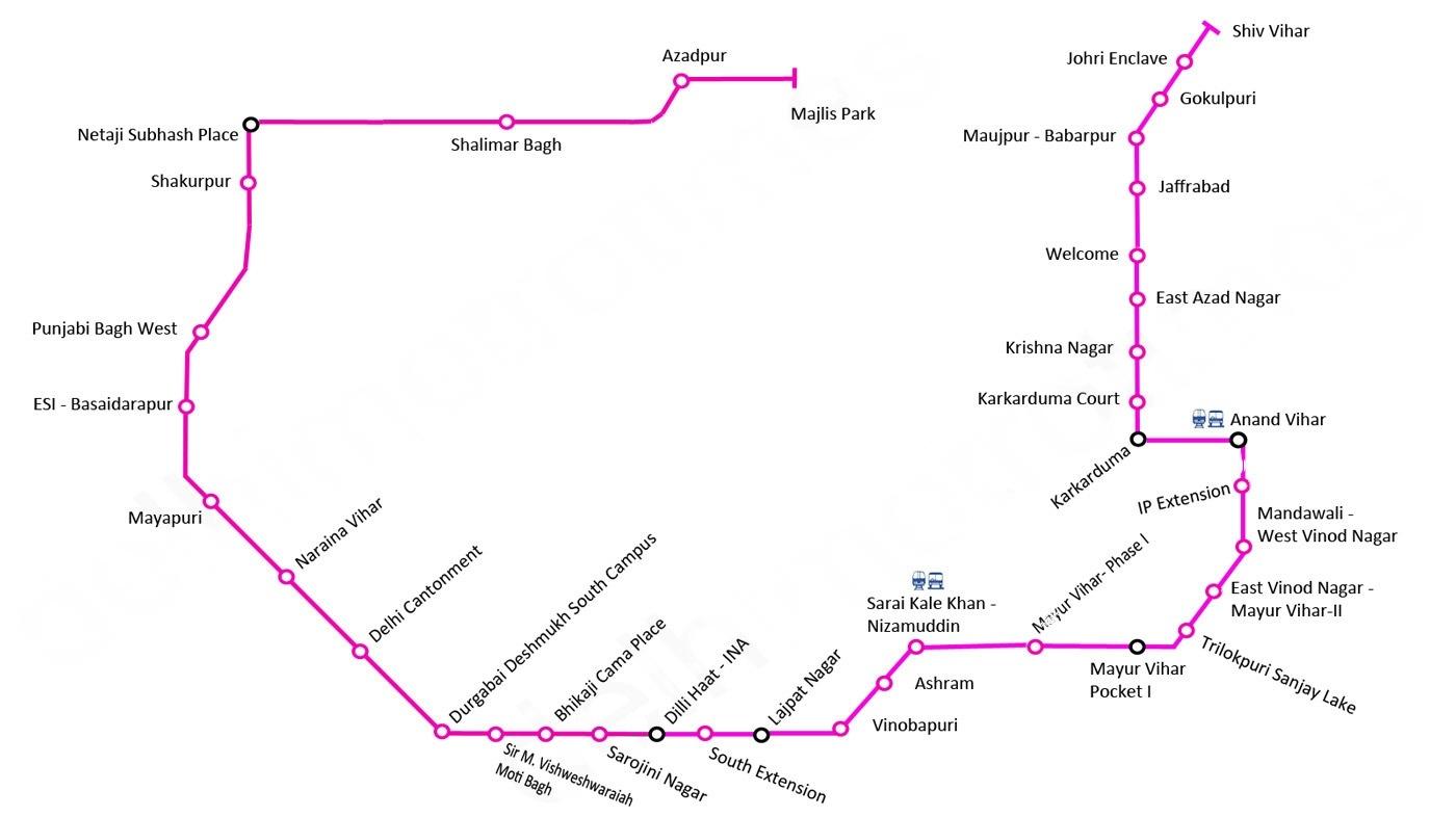
Delhi Metro Pink Line (Line 7): Majlis Park to Shiv Vihar
Pink Line Delhi Metro is one of the network's longest and most strategically important lines. It forms a semi-ring around the city, stretching from Majlis Park to Shiv Vihar. It connects major residential and commercial zones across North, West, and East Delhi.

Stations
| Station | Interchange |
| Majlis Park | No |
| Maujpur-Babarpur | Yes (Blue Line - Line 3/4) |
| Gokulpuri | No |
| Johri Enclave | No |
| Shiv Vihar | No |
| Welcome | Yes (Red Line - Line 1) |
| Jafrabad | Yes (Red Line - Line 1) |
| Karkarduma | Yes (Blue Line - Line 3/4) |
| Karkarduma Court | Yes (Blue Line - Line 3/4) |
| Krishna Nagar | No |
| East Azad Nagar | No |
| Anand Vihar ISBT | Yes (Blue Line - Line 3/4, Vaishali to Yamuna Bank) |
| Mayur Vihar Phase-I | Yes (Blue Line - Line 3/4) |
| Mayur Vihar Pocket-1 | Yes (Blue Line - Line 3/4) |
| Trilokpuri Sanjay Lake | No |
| Mandawali West Vinod Nagar | No |
| I.P. Extension | No |
| Akshardham | Yes (Blue Line - Line 3/4) |
| New Ashok Nagar | Yes (Blue Line - Line 3/4) |
| Patel Nagar | Yes (Blue Line - Line 3/4) |
| Supreme Court | No |
| Pragati Maidan | Yes (Blue Line - Line 3/4) |
| Inderlok | Yes (Green Line - Line 5) |
| INA | Yes (Yellow Line - Line 2) |
| South Extension | Yes (Yellow Line - Line 2) |
| Lajpat Nagar | Yes (Violet Line - Line 6) |
| Vinoba Puri | No |
| Ashram | Yes (Violet Line - Line 6) |
| Sarai Kale Khan - Nizamuddin | No |
| Durgabai Deshmukh South Campus | No |
| Sir M. Vithaldas College | No |
| Bhogal | No |
| Shalam Bagh | No |
| Azadpur | Yes (Yellow Line - Line 2) |
| Punjabi Bagh West | No |
| ESI Basaidarapur | No |
| Rajouri Garden | Yes (Blue Line - Line 3/4) |
| Mayapuri | Yes (Blue Line - Line 3/4) |
| Naraina Vihar | No |
| Delhi Cantt | Yes (Yellow Line - Line 2) |
| Shakurpur | No |
| Netaji Subhash Place | Yes (Yellow Line - Line 2) |
Travel Time and Frequency
- The entire journey from Majlis Park to Shiv Vihar takes approximately 83 minutes.
- Trains run at a frequency of 5-10 minutes during peak hours and 10-15 minutes during off-peak hours.
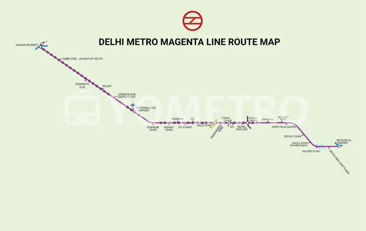
Delhi Metro Magenta Line (Line 8): Janakpuri West to Botanical Garden
The Magenta Line Metro route is a modern, high-speed corridor in the Delhi Metro network, connecting Janakpuri West in West Delhi to Botanical Garden in Noida. This line is mostly underground and has 26 metro stations.
Stations
| Station | Interchange |
| Janakpuri West | Yes (Blue Line - Line 3/4) |
| Dabri Mor | No |
| Dashrath Puri | No |
| Palam | No |
| Sadar Bazar Cantonment | No |
| Terminal 1-IGI Airport | No |
| Shankar Vihar (Restricted civilian entry) | No |
| Vasant Vihar | No |
| Munirka | No |
| R.K. Puram | No |
| IIT Delhi | No |
| Hauz Khas | Yes (Yellow Line - Line 2) |
| Panchsheel Park | No |
| Chirag Delhi | No |
| Greater Kailash | No |
| Nehru Enclave | No |
| Kalkaji Mandir | Yes (Violet Line - Line 6) |
| Okhla NSIC | No |
| Sukhdev Vihar | No |
| Jamia Millia Islamia | No |
| Okhla Vihar | No |
| Jasola Vihar Shaheen Bagh | No |
| Kalindi Kunj | No |
| Okhla Bird Sanctuary | No |
| Botanical Garden | Yes (Blue Line - Line 3/4) |
Travel Time and Frequency
- The total travel time from Janakpuri West to Botanical Garden is approximately 1 hour 15 minutes.
- However, travel time can vary depending on several factors, such as train speed, stops, and passenger load.
- Trains on the Magenta Line typically run every 5-10 minutes during peak hours and every 10-15 minutes during off-peak hours.
Delhi Metro Grey Line (Line 9): Dhansa Bus Stand Dwarka to Bahadurgarh City Park
The Grey Line Delhi Metro is the shortest line in the entire Delhi Metro network, providing crucial last-mile connectivity in West Delhi. This line stretches from Dwarka to Dhansa Bus Stand and has four metro stations.

Station List
- Dhansa Bus Stand Dwarka (Terminus)
- Nangli
- Najafgarh (Terminus)
Travel Time and Frequency
- It takes approximately 6 minutes to travel from Dwaraka to Dhansa Bus Stand on the Grey Line.
- Trains run very frequently on this short route, typically every 2-3 minutes during peak hours and every 5-10 minutes during off-peak hours.
- Please note that the Grey Line is a short line with only three stations.
Delhi Metro Orange Line (Airport Express): New Delhi to Dwarka Sector 25
The Orange Line Delhi Metro, also known as the Airport Express Line, is a premium corridor that connects New Delhi Railway Station to Dwarka Sector 21, with key stops at Shivaji Stadium, Dhaula Kuan, Delhi Aerocity, and IGI Airport Terminal 3.

Stations
| Stations | Interchange |
| New Delhi (Interchange with Yellow Line) | |
| Shivaji Stadium | |
| Dhaula Kuan (Interchange with Pink Line) | Through travelators |
| Delhi Aerocity | |
| IGI Airport | |
| Indira Gandhi International Airport Terminal-3 | |
| Dwarka Sector 21 (Interchange with Blue Line) | |
| Yashobhoomi Dwarka Sector 25 (Terminus) |
Travel Time and Frequency
- Travel time: Approximately 21 minutes.
- Frequency: Trains run on the Airport Express Line every 3 minutes throughout the day, making it the most frequent line of the Delhi Metro.
Delhi Metro Orange Line: Additional Information
- The Orange Line is designed for fast travel, with trains reaching speeds of up to 120 km/h.
- The coaches are air-conditioned and have comfortable seating.
- Luggage racks are available for passengers with heavier baggage.
- Tickets for the Airport Express Line are slightly more expensive than other Delhi Metro lines.
Metro’s Impact on Delhi’s Urban Growth
The Delhi Metro has made a big difference in how the city looks and grows. Here's how it changed things:
- Easier to Go Around: The metro made it much easier for people to travel. Now, you can quickly reach different parts of the city without spending much time stuck in traffic.
- Fewer Traffic Jams: With more people using the metro, fewer cars are on the road. This has helped to ease the traffic jams and make the air cleaner.
- New Shops and Jobs: New shops and businesses have popped up around metro stations. This has created more jobs and made these areas busier and more exciting.
- Homes and Offices Everywhere: Places near metro stations have become more popular for living and working. This has led to more houses and offices being built in these areas.
- People from Everywhere: The metro has connected different parts of the city, bringing people together. It doesn't matter where you live – the metro makes it easy for everyone to move around.
- More Jobs Because of the Metro: Building and running the metro has created many jobs. From building the metro to running it every day, lots of people now have work because of it.
- Tourists Love It: Tourists find it easy to explore Delhi with the metro. This has brought more people to the city, helping businesses and making Delhi even more exciting.
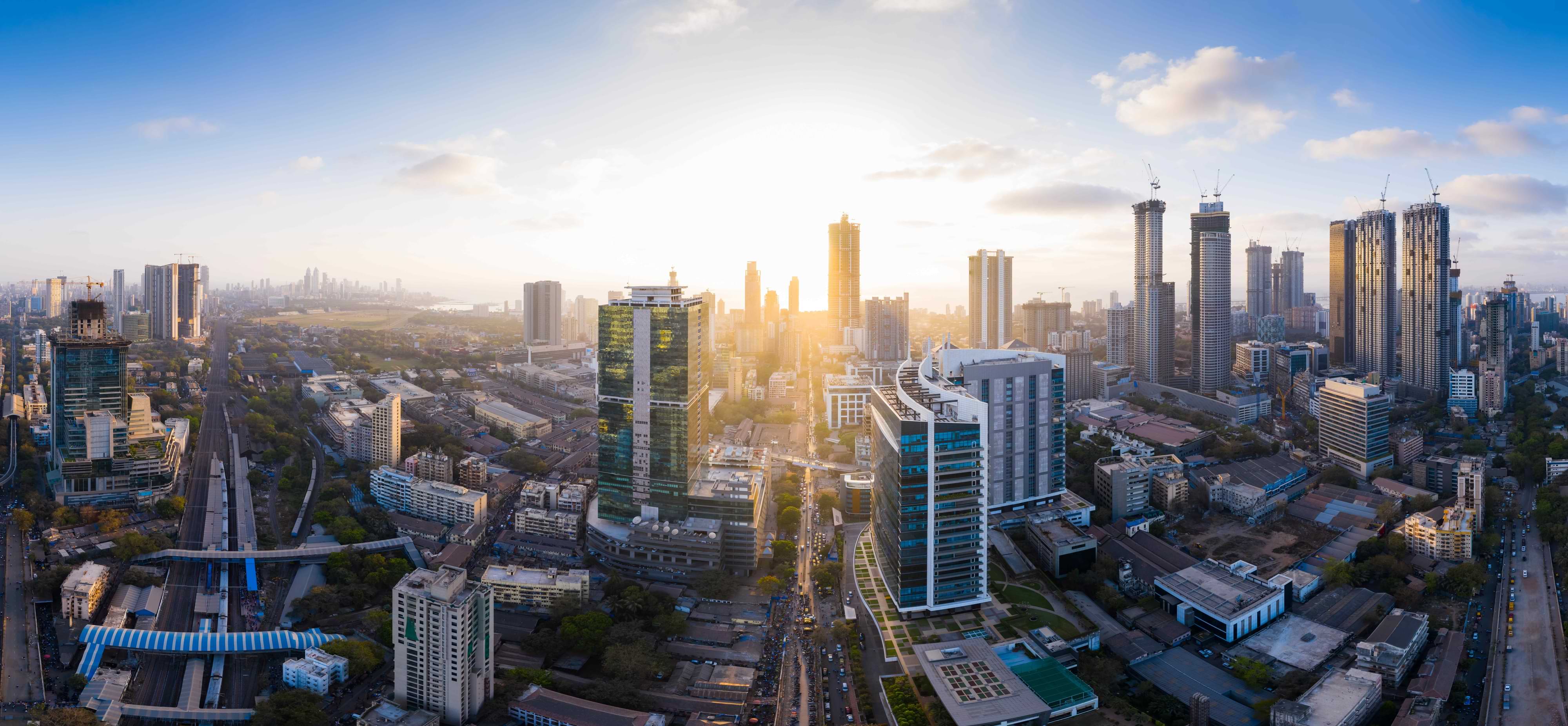
Real Estate Boom Because of the Delhi Metro
Delhi Metro has played a crucial role in sparking a real estate boom in the city. Here's how the metro system has influenced the real estate sector:
- Proximity to Metro Stations: Areas around metro stations have become prime locations for real estate development. The convenience and accessibility offered by the metro have made these areas highly desirable for both residential and commercial purposes. As a result, property values in proximity to metro stations have surged.
- Increased Demand: The improved connectivity provided by the metro has increased the overall demand for properties near metro stations. Homebuyers and businesses are attracted to areas with easy access to public transportation, leading to a higher demand for real estate in these locations.
- Rise in Commercial Spaces: Metro stations have become hubs for commercial activities. The increased footfall around these stations has led to a surge in demand for commercial spaces, such as offices, retail outlets, and entertainment venues. Real estate developers have responded by constructing commercial complexes near metro stations to cater to this demand.
- Infrastructure Development: The development of the metro system often goes hand in hand with other infrastructure projects. Improved roads, better civic amenities, and enhanced urban planning in the vicinity of metro stations contribute to the overall attractiveness of these areas for real estate development.
- Higher Returns on Investment: Investors have recognised the potential for higher returns on investment in areas connected by the metro. The increased demand for properties in these locations has translated into a greater appreciation of real estate values over time.
- Urban Renewal: The construction of metro lines has sometimes led to urban renewal projects, transforming previously neglected or underdeveloped areas. These revitalised neighbourhoods attract real estate developers who see the potential for growth and profitability.
- Improved Connectivity to Job Hubs: Metro connectivity to major employment hubs has made areas around these hubs more appealing for real estate development. Commuters are willing to pay a premium for properties that offer easy access to their workplaces through the metro.
- Positive Perception: The presence of a metro station in an area positively influences its perception. Homebuyers and businesses often associate metro connectivity with modernisation, convenience, and a higher quality of life, leading to increased interest in real estate in these areas.
Areas That Experienced Real Estate Growth Due to the Delhi Metro
The real estate boom spurred by the Delhi Metro has influenced specific localities across the city. Here are some prominent areas that have experienced significant growth in real estate development due to their proximity to metro stations:
- Connaught Place: Connaught Place, the heart of Delhi, and its surrounding areas have witnessed increased demand for both commercial and residential properties. The metro's connectivity has added to the allure of this central business district.
- Saket: With a well-connected metro station, Saket has become a thriving locality for real estate. The combination of commercial spaces, shopping complexes, and residential developments has made it a sought-after area.
- Rohini: The metro development in Rohini has transformed it into a bustling residential and commercial hub. Accessibility to the metro has significantly boosted real estate activities in this North Delhi locality.
- Dwarka: Dwarka, with its planned sub-city model and metro connectivity, has become a preferred destination for homebuyers. The real estate market in Dwarka has flourished, offering a mix of residential apartments, commercial spaces, and recreational facilities.
- Noida: Noida, a neighbouring city in the National Capital Region (NCR), has experienced substantial real estate growth due to metro connectivity. Areas like Sector 18 and Sector 62 have become commercial hotspots, while residential sectors have seen increased demand.
- Gurgaon (Gurugram): The advent of the metro in Gurgaon has significantly impacted the city's real estate landscape. Cyber City and Golf Course Road, connected by the metro, have witnessed the development of high-end residential complexes and commercial spaces.
- Mayur Vihar: Mayur Vihar, with its well-connected metro station, has seen a surge in residential real estate. The area's proximity to educational institutions and commercial centres has contributed to its popularity among homebuyers.
- Lajpat Nagar: Lajpat Nagar, located in South Delhi, has experienced increased real estate activity due to metro connectivity. The commercial areas and residential pockets around the metro station have become prime locations for investment.
- Rajouri Garden: This West Delhi locality has seen a boost in real estate development, particularly around the metro station. The area's accessibility and commercial vibrancy have attracted businesses and residents alike.
- Vaishali (Ghaziabad): The metro extension to Vaishali in Ghaziabad has led to a surge in real estate demand. The area has become a popular choice for those seeking affordable housing options with convenient metro connectivity.
Latest News and Information About Delhi Metro 2025
Commuters can now purchase Delhi Metro tickets directly through the Rapido app. Rapido has partnered with DMRC and the Open Network for Digital Commerce (ONDC). This integration brings metro ticketing into the Rapido ecosystem, making ticket purchases as easy as booking a ride. DMRC has started installing steel railings across all 29 interchange stations to improve safety and crowd control. These barriers are designed to streamline passenger movement, prevent accidental falls onto the tracks, and help avoid service disruptions caused by dropped objects.
On the expansion front, Delhi Metro is gearing up to add 44 new stations under Phase 4, with priority corridors expected to be operational by March 2026. Notable segments include:
- Magenta Line: Janakpuri West to Krishna Park Extension (opened January 5, 2025) economictimes.
- Pink Line extension: Majlis Park to Maujpur
- Golden corridor: Aerocity to Tughlakabad
- Green Line extension: Inderlok to Indraprastha
Estimates suggest the expanded network will cover roughly 112 km and include 44 stations across six corridors, boosting connectivity across Delhi-NCR.
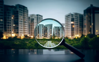
Invest Near Delhi Metro with NoBroker
As the Delhi Metro continues to expand and connect various parts of the city, the ripple effect on real estate is undeniable. The convenience, accessibility, and improved connectivity provided by the Delhi Metro have made these localities highly sought after for both homebuyers and businesses. As the city continues to evolve, the Delhi Metro remains at the forefront of this transformation, contributing to a more interconnected, accessible, and vibrant urban environment. Explore the real estate opportunities near Delhi Metro stations with NoBroker and be a part of the ever-growing and dynamic landscape of India's capital city.
Frequently Asked Questions
Delhi Metro is a rapid transit system serving the National Capital Region (NCR) in India. It's a vast network of interconnected metro lines providing efficient and comfortable transportation.
Delhi Metro was inaugurated on December 24, 2002, with the opening of the Shahdara to Tis Hazari section of the Red Line.
The metro system has undergone significant expansion, adding new lines and extending existing ones. It now covers various parts of Delhi and extends into neighbouring cities of NCR.
Delhi Metro operates on multiple lines, each designated by a specific colour. As of the latest information, several lines are covering different routes across the city.
Delhi Metro generally operates from around 6:00 AM to 11:00 PM. However, specific timings may vary slightly on different lines and stations.
Recommended Reading
Top 20 Posh Areas in Delhi: Connectivity, Amenities, and Localities to Live in 2025
May 16, 2025
162513+ views

Delhi Metro Yellow Line Route Map, Timings, Interchange Stations & Fare Info in 2025
January 10, 2025
108692+ views
Blue Line Delhi Metro: Stations, Timings, Fares & Route Map , Latest Updates in 2025
January 28, 2025
92948+ views
Delhi Metro Pink Line: Route, Map, Fares, Timings, and Stations List in 2025
February 2, 2025
87100+ views

Lajpat Nagar Metro Station Delhi: Map, Routes, Parking and Nearby Localities to Live in 2025
March 21, 2025
57361+ views
Loved what you read? Share it with others!
Most Viewed Articles
Bangalore Metro: Map Route, Timings, Lines, Stations List and Updated News 2025
May 4, 2025
476275+ views
Top 12 Richest Cities in India: GDP and Ranking in 2025
March 13, 2025
345323+ views

Purple Line Metro Bangalore: Routes, Maps and Timings and Fares
May 1, 2025
263106+ views
Yellow Line Metro Bangalore: Route, Map Timings, Stations and Fares in 2025
May 2, 2025
251857+ views
The Green Line Metro Bangalore: Routes, Maps, fares and Nearby Residential Areas
April 10, 2025
215924+ views
 Author
Recent blogs in
Top 15 IT Companies in Gurgaon: Leading Global Tech and Software Firms in 2026
January 22, 2026 by Nithin
Yerwada Metro Station Pune: Map, Station Lists, Fares and Nearby Localities to Live in 2026
January 20, 2026 by Krishnanunni H M
Seelampur Metro Station Delhi: Map, Stations, Fares and Nearby Localities to Live in 2026
January 19, 2026 by Kruthi


 Full RM + FRM support

Join the conversation!